Ngoutou Permit, Gabon, Central Africa
Permit and Location
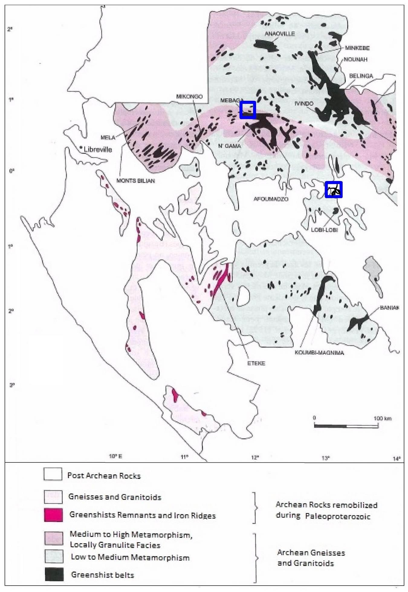
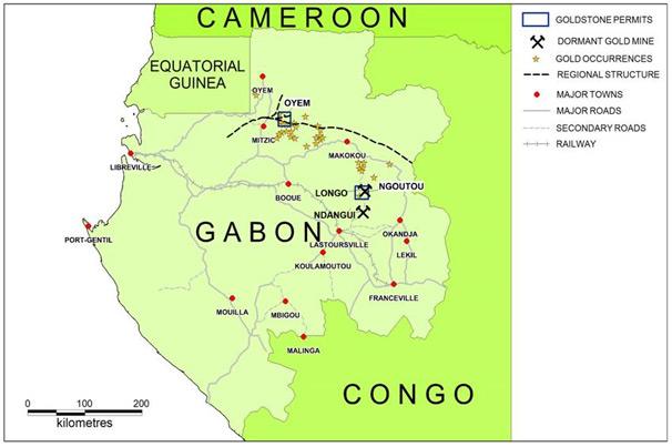
The Ngoutou permit in eastern Gabon is 515 km² in size and can be reached from the provincial capital Lastoursville on gravel roads (Figure 1). The permit was granted to GoldStone’s 100% owned Gabonese subsidiary GoldStone Resources Limited Gabon S.A.R.L. in April 2011 for a period of three years and can be renewed twice for a period of three years.
Regional Prospectivity
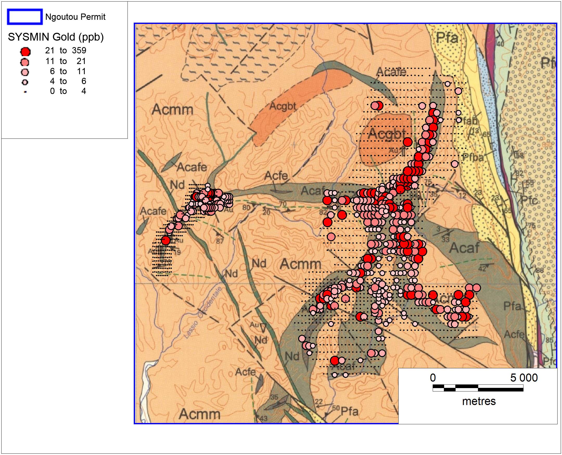
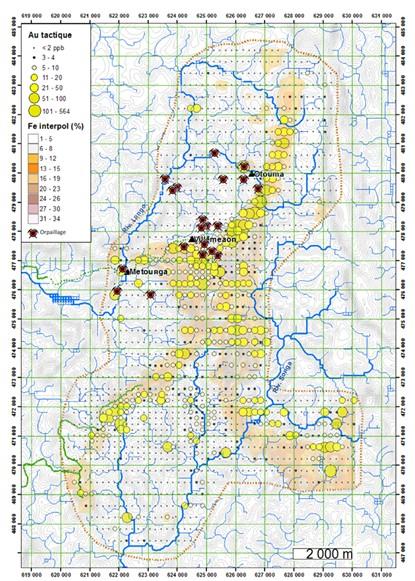
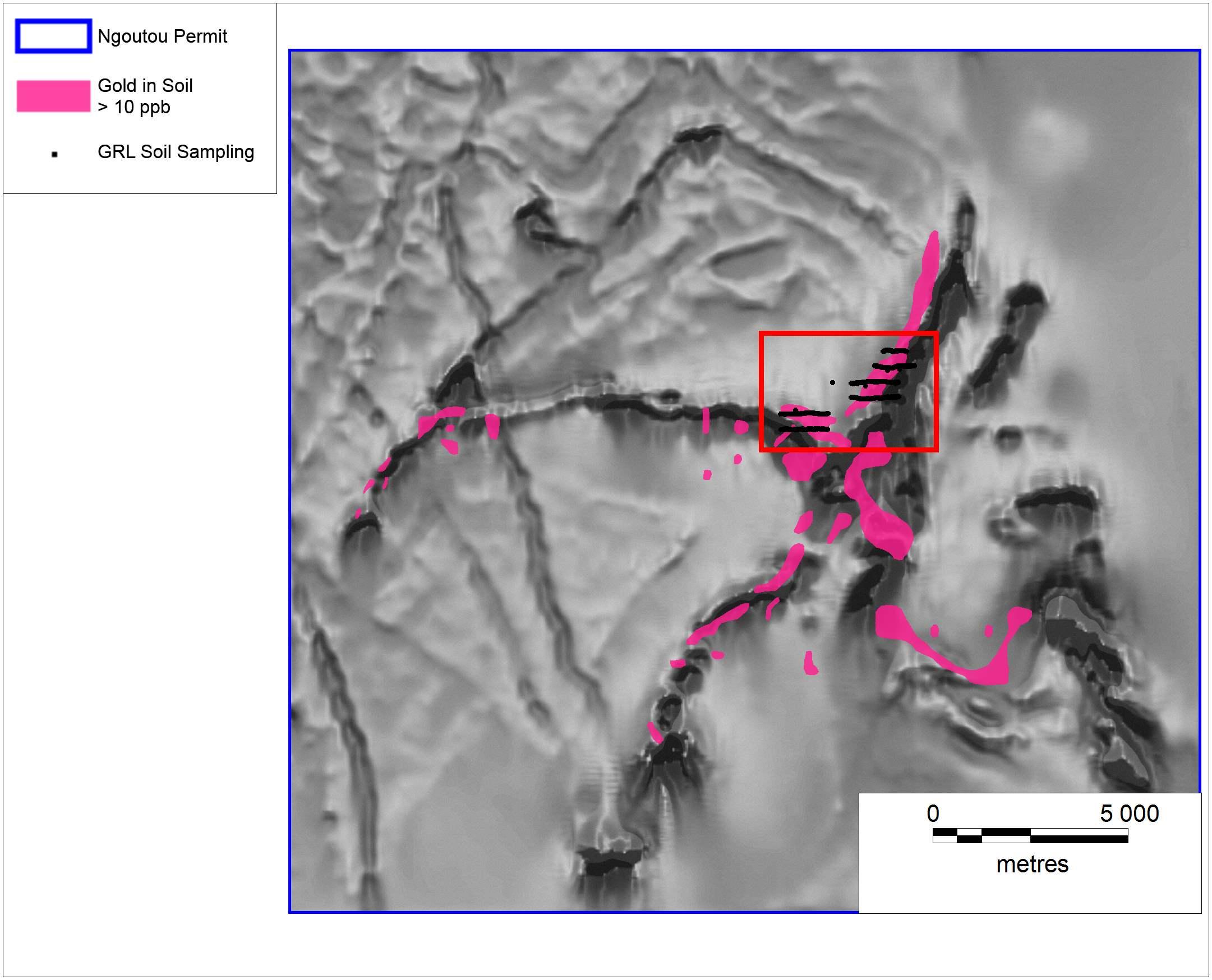
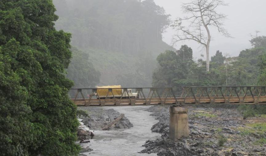
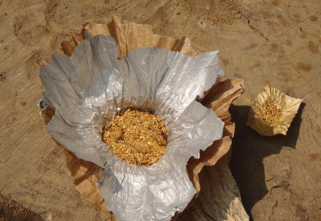
The Ngoutou permit contains a robust gold in soil anomaly which is in excess of 15 km long and is located over an Archean greenschist belt (Figures 2 and 3). The anomaly was detected together with several other anomalies during the period from 2005 to 2009 when 14 million Euros of European Union funding was applied in a survey (‘Sysmin Survey’) by the French, South African and Gabonese Geological Surveys to outline the mineral prospectivity of Gabon. The Ngoutou permit was applied for after the area was “cherry picked” from the Sysmin Survey results by GoldStone’s geologists. Many of the streams which drain the anomalous area have been targeted by artisanal gold miners and mining of alluvial gold is the principal source of income of the locals living in three villages on the north-western flank of the gold anomaly (Figure 4). Geological mapping and the results of an airborne magnetic survey (Figures 3 and 5) demonstrated that the gold in soil anomaly coincides with a “starfish” shaped complex of Archean amphibolites, diorites and ultramafic rocks, as well as banded iron formation (“BIF”), itabirites and younger felsic intrusives. In particular, gold anomalism seems to peak where mafic rocks and BIF’s are in contact with felsic rock units. This would point to a model where gold was precipitated from mesothermal solutions at lower crustal levels as a result of neighbouring rock types that differ in competence and chemistry. The magnitude and size of the soil anomaly together with a plausible geological model make this permit highly prospective.
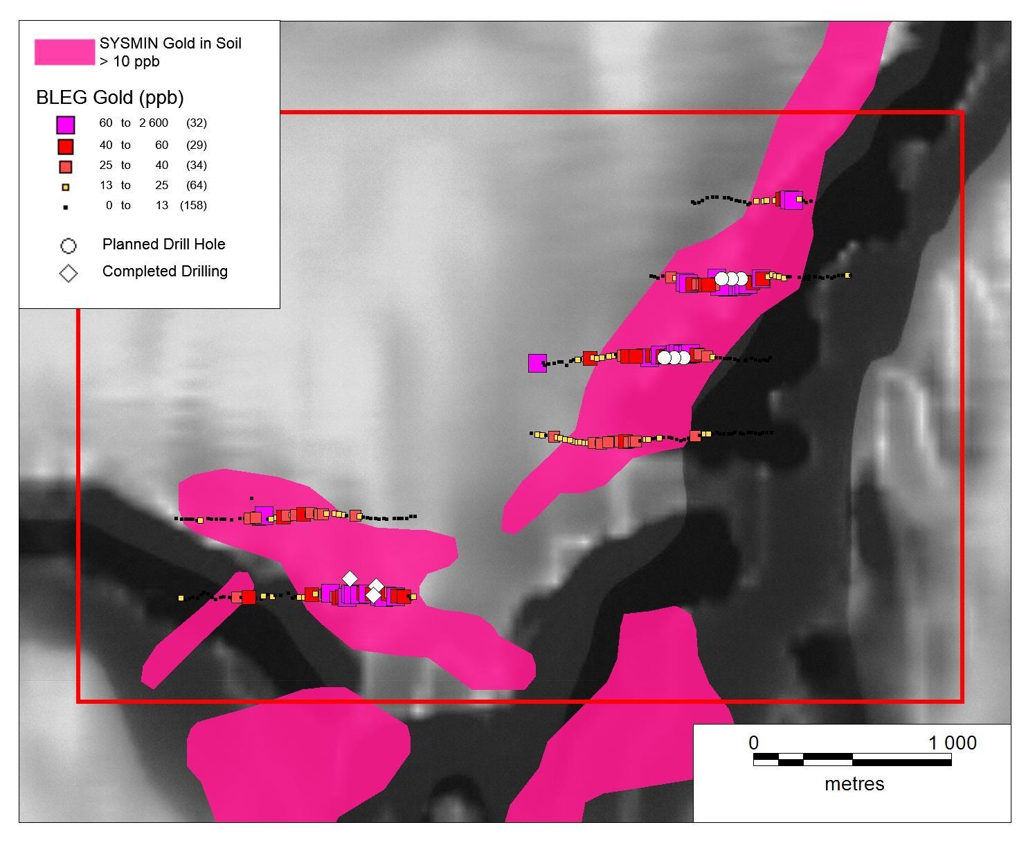
GoldStone’s Exploration Approach
Pitting and mapping demonstrated that the weathering and clay in the area is too deep for trenching or cheaper, shallow drilling techniques to be a viable exploration tool. A detailed confirmatory and infill soil sampling programme on a 200m by 25m grid, using the MMI and BLEG methods, over the central portion of the initial soil anomaly, which confirmed the results of the SYSMIN programme, was therefore directly followed up with a three hole diamond drilling programme (Figure 6). The drilling of these holes was completed during May 2013, while a number of drill targets further to the north have been prepared and will be tested in the future.