Sangola Licence – Senegal
Location
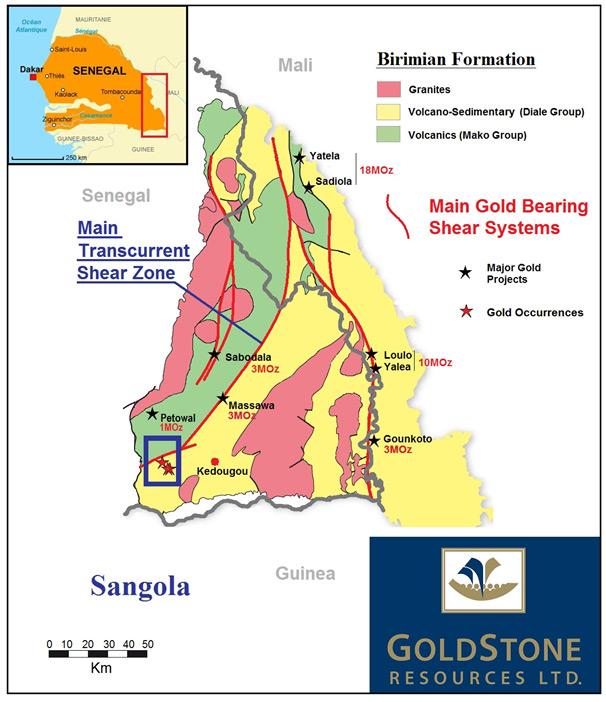
The licence area is 471 km² in extent and located in the gold-prospective Kenieba Inlier of Birimian Formation, 30 km west of Kedougou (Figure B1), the regional capital city. From Dakar the permit is reached on tarred roads via Tambacounda to Kedougou.
Prospectivity
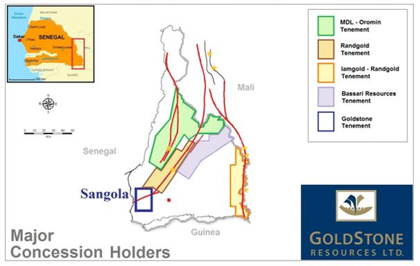
The area covered by the licence locates in the highly prospective Kenieba Inlier of Birimian Formation where modern exploration resulted in the discovery of more than 30 million ounces (“Moz”) of gold in Mali and Senegal. The licence covers the south-western part of the Main Transcurrent Shear Zone (“MTZ”), a major shear system that also controlled the formation of the recently discovered 3.6 Moz Massawa gold deposit (Randgold Resources Ltd). The Massawa gold project is presently undergoing a feasibility study and might be the second modern gold mine in Senegal after first gold was poured at Teranga’s Sabodala gold mine during March 2009. Further to the north the same gold belt is targeted with extensive exploration by Teranga (previously MDL) and Bassari (Figure B2). Both companies have discovered mineralisation (Sounkounkou and Sanbarabougou) within this 70 km long gold anomalous belt. The licence also covers the very prospective volcanic rocks (Mako Formation) which host the 3 Moz Sabodala deposit and Toro Gold’s recently discovered 1 Moz Petowal deposit. Despite its strategic position the licence area was still largely unexplored when GoldStone was granted the permit in October 2010.
GoldStone’s Exploration
Since October 2010 the company carried out an extensive surface sampling programme, Rotary Air Blast (“RAB”) drilling and an airborne geophysical survey. In summary, the results of the surface sampling were very positive and pointed to four large gold anomalies (Figures B3) in favourable structural settings.
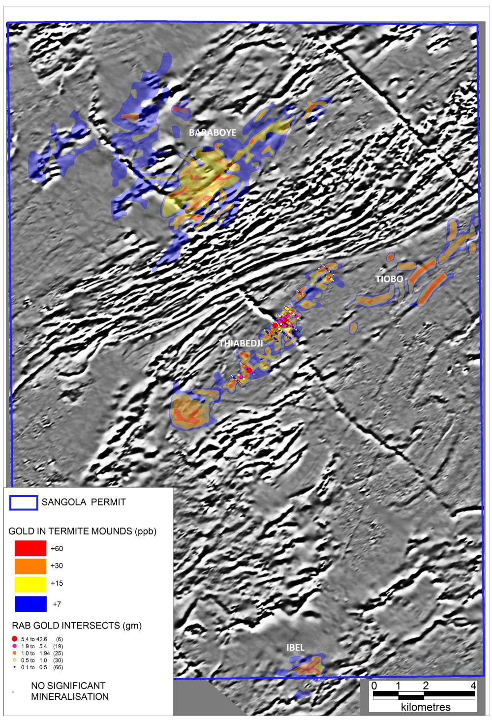
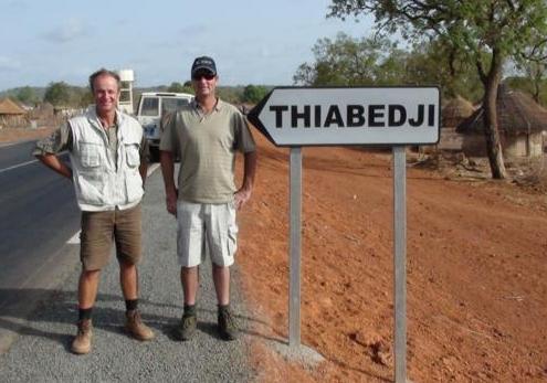
Figure B3: Surface sampling over the Sangola permit area yielded four large gold anomalies named Thiabedji, Baraboye, Tiobo and Ibel. A grey scale image in the background depicts the results of an airborne high-resolution magnetic survey. The magnetic survey also indicated that the Baraboye, Thiabedji and Tiobo anomalies coincide with highly prospective smaller structures splaying off or running parallel to larger structures. RAB drilling over the Thiabedji anomaly was carried out during 2012.
The surface sampling programme consisted of approximately 10,000 samples taken from termite mounds at 400 metre by 100 metre and 200 metre by 50 metre spacings, covering the largest part of the permit area. Results included gold values of up to 259 ppb and defined four robust gold anomalies, named Baraboye, Thiabedji, Tiobo and Ibel. In order to gain a better understanding of the geology and the hydrothermal processes that resulted in the gold mineralisation, the samples were also analysed for a range of other trace elements, such as silver and arsenic.
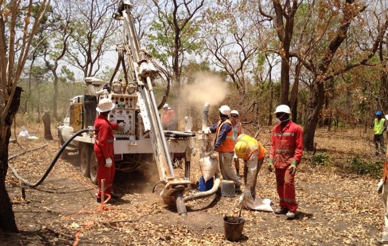
RAB drilling during the 2012 dry seasons was limited to the more than six kilometre long Thiabedji gold anomaly where 11,348 metres were drilled along 13 lines in 418 drill holes averaging 27 metres in depth. Results from the central part of the anomaly delineated a 1.2 km long mineralised trend which is up to 70 metres wide. Results from this area include 9 metres @ 4.7 g/t gold (including 3 metres @ 11.8 g/t gold) and 3 metres @ 4.9 g/t gold. The programme also yielded a large number of low grade intersects; i.e. 117 intersects between 0.1 g/t and 0.5 g/t.